Hiking route to the Drumont on the Russier path
 Departure/Arrival
 Point of interest
Presentation
Length: 10km - Heigth difference: 580 m - Duration: 4h - Markings: Blue rectangle - Blue point - Intermediate level.
Departure from the car park of the Source de la Moselle.
Take the road that goes up and join the national road RN66 on 150 m. Go along the RN66 for 100 m, then take the path that goes up on the left, marked out blue rectangle GR 531, direction "Sommet du Drumont". This path, called "Sentier des Russiers", leads up to the Drumont road.
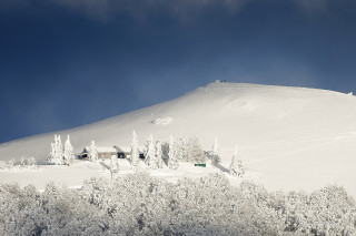
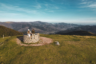
Follow this road for about 300 m, then take the blue rectangular path GR 531 which climbs on the right for about 2 km. You will finally arrive on the stubble of the Drumont, where you will follow the ridge up to the orientation table.
A glance over the valley reveals Bussang, nestled on the side of the Tête des Corbeaux. The panorama view on the Ballon d'Alsace, the Rossberg and the Grand Ballon is simply amazing. To the south, on a very clear day, you can see the Swiss Alps. The panorama offers an alternation of wooded summits and urbanized valleys.
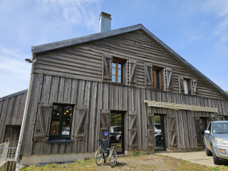
From the orientation table, go down from the opposite side. At the intersection, take the path to the left (blue rectangle GR 531 "Auberge du Drumont"), which leads you to the farm inn.
Below the car park, follow the blue point signs "Bussang - Plain du Repos". The path leads to the road which you will follow for about 300 m, before taking a path on your right below. You arrive at the Chalet du Plain du Repos. To the left of the chalet, always follow the blue point marked path, which leads to the Chalet de la Petite Montagne. Then follow the forest road to the left, signposted in blue "Bussang par le Charat".
Possibility to make a small detour (about 150 m) to the Charat viewpoint, with a beautiful panorama on the Col de Bussang. It is here that the first part of the "rando ferrata de la source de la Moselle" ends, a trail mixing hiking and climbing along a fixed cable and facilitated by bars, footbridges... (Activity in free access, requiring special equipment: helmet, harness and lanyards with absorbers. - For more information, contact the Tourist Office of Bussang).
Leave this path to take the one on the right, blue point mark (be careful not to take the route back from the rando ferrata). The path leads to the "route du charat". Follow this road to the left for about 350 m, before reaching the "route des sources"(It is possible to have a short walk to the Source Marie, taking the "route des sources" to the right).
The Source Marie is the last vestige of the thermal city that was Bussang in the passt. Surrounded by a pretty park, the Marie source is sheltered by a kiosk whose entrance is free, andopen all year round. You can taste its naturally sparkling mineral water (free of charge), recommended at the time for the treatment of anaemia because rich in iron.
At the crossroad with the route des sources turn left. Walk past the "Etang des Sources" and the car park of the "Rando Ferrata de la Source de la Moselle"; follow the road for about 1 km before reaching the Moselle source and its car park.
The Gpx route and the sheet of the hike can be downloaded above.
IGN hiking map reference 3619 OT or personalized map hiking around Bussang only available at the tourist office of Bussang.
From Tuesday 15 April 2025 to Monday 30 November 2026
Every day
- Documents available in: :
- English
- German


