Mountain bike route n.14 - La Botiotte - departure: tourist office
- Mountain Bike
Distance in kms
:
23
Difference in altitude
:
430
Black
 Departure/Arrival
 Point of interest
Circuit n° 1
Circuit n° 2
Circuit n° 3
Presentation
Route marked FFC, start from the tourist office: Track N ° 14 La Botiotte.
Difficulty level: black - Length 23 km - elevation + 430 m.
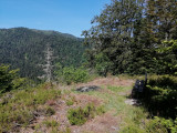
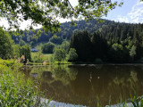
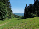
Route that allows you to discover the Charbonniers valley, the Botiotte Chapel, the Plain des Loges, the Plain du Canon.
The map of the Hautes-Vosges mountain bike circuits can be download.
The GPx track for the route can be download below.
Opening day(s)
All year long -2024
Every day
Good to know
- Documents available in: :
- English
- German
- Dutch
Pics


Contact details of the owner
Mountain bike route n.14 - La Botiotte - departure: tourist office
28 bis rue de Lorraine
Office de Tourisme
88560
SAINT MAURICE SUR MOSELLE
Phone : +33 3 56 11 00 90