MTB itinerary n °4 - La Lochère - departure: Col de la Lochère
- Mountain Bike
Distance in kms
:
19
Difference in altitude
:
525
 Departure/Arrival
 Point of interest
Circuit n° 1
Circuit n° 2
Circuit n° 3
Presentation
Signposted circuit starting from Col de la Lochère: circuit n ° 4 "La Lochère".
Difficulty level: red. Lenght: 19 km. Elevation: 525 meters.
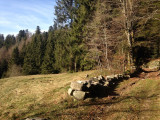
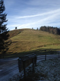
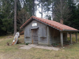
Circuit which allows to discover the Col de Rochelotte, the top of the ski slopes of Frère Joseph, the site of Forgoutte and the maquis of Peut-Haut.
The map of the Hautes-Vosges mountain bike circuits is downloadable.
The GPX track of the route can be downloaded below.
Opening day(s)
All year long -2024
Every day
Good to know
- Documents available in: :
- English
- German
- Dutch
Pics


Contact details of the owner
MTB itinerary n °4 - La Lochère - departure: Col de la Lochère
rue de la Chapelle des Vés
Col de la Lochère
88160
FRESSE SUR MOSELLE
Phone : +33 3 56 11 00 90
We also suggest...


