Trail route n°5 - Les Étangs
- Trail
 Departure/Arrival
 Point of interest
Presentation
Length of the route: 14.57 km – Elevation gain: 450 m – Duration: 1 hour 40 minutes to 3 hours 20 minutes – Markings: Trail sign n°5 blue + Club Vosgien sign – Level: Medium.
Start: the crossroad between : rue des brasseries, rue du Clos Martin and Grand rue.
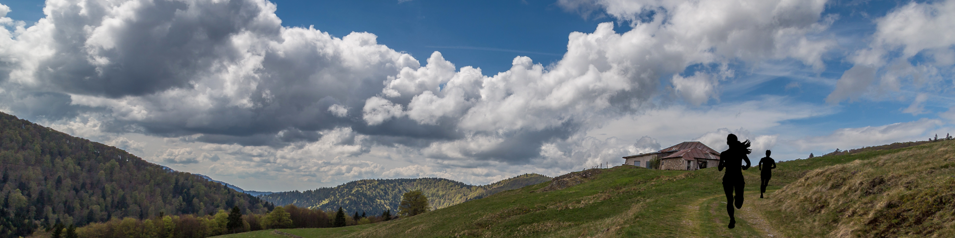
A lovely route starting from the village of Ramonchamp, with a moderate elevation gain that allows you to vary your pace.
Remember that in the mountains, you are always on someone’s land and they are tolerating your presence; on this route, you may come across the landowner’s dogs in the Pré Martin area.
The first part of this loop climbs steadily towards Haut de Grammont and its chalet, mainly through woodland, along fairly narrow and wild paths. The climb continues for a few more kilometres before reaching the path leading onto the Plateau des Étangs, offering a breathtaking panorama.
The route then runs alongside the Étang de la Plancherotte, the Noirs Étangs, and then the Étang Noir, before a final push past the Chalet de l'Alouette towards Haut de la Parère.
The descent towards the village provides a pleasant conclusion to the loop.
The routes on your smartphone...
All the routes of the Espace Trail des Ballons des Vosges are available free of charge on your smartphone thanks to the Trail Connect app in the ‘Destinations à découvrir’ (Destinations to discover) section.
GPX and PDF files of the tour can be downloaded below.
All year long 2026
Every day