Orientation table of Chaillon


Presentation
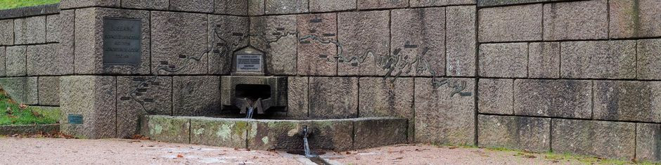
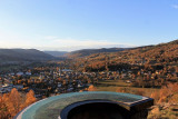
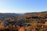
The summit of Chaillon, at an altitude of 634 meters, is a calm and peaceful place.
This little hill is easily accessible from the church of Le Thillot and offers sumptuous panoramas on the valley. The main one is embellished with an orientation table which allows you to recognize the surrounding tops.
Nearby are benches, picnic areas and even a charming little pond nestled in a corner of greenery.
Follow our family walking route, which will take you to this lovely panorama view.
Opening day(s)
All year long -2024
Every day
Informations
- Category of environmental heritage :
- Regional country park
- Conditions of visit (groups) :
- Visit on your own at all times
- Signposted footpaths
- Conditions of visit (individuals) :
- Visit on your own at all times
- Signposted footpaths
- Location :
- In the country
- In a Regional Country Park
- Beside a lake
- In a woodland setting
- In the mountains
Destination
Table d'orientation de Chaillon
Chaillon
88160
LE THILLOT
GPS coordinates
Latitude : 47.88236
Longitude : 6.77365
Contact
Orientation table of Chaillon
Chaillon
88160
LE THILLOT
Phone : +33 3 56 11 00 90